
PUNCH: turning four spacecraft into a solar-wind observatory
PUNCH combines four cameras, polarized light and careful calibration to follow solar material from the corona across the inner solar system.
First light begins the measurement work
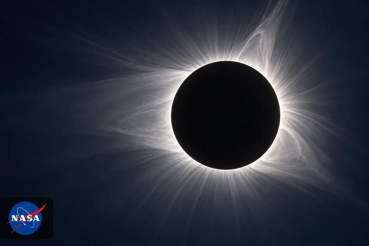
PUNCH’s four Earth-orbiting spacecraft work as one solar observatory. On April 18, 2025, the first images from NASA’s PUNCH mission were publicly circulating. They showed stars and zodiacal light, the glow of sunlight scattered by interplanetary dust. Those backgrounds demonstrated functioning cameras, but they also illustrated the challenge ahead: revealing much fainter solar material. Principal investigator Craig DeForest, working at Southwest Research Institute in Boulder, Colorado, described instruments operating as intended while on-orbit commissioning continued. NFI and WFI-2 opened on April 14; the remaining two wide-field cameras opened on April 16. The mission follows the corona’s transition into the solar wind. Its propulsion system passes current through water to produce hydrogen and oxygen, which burn for manoeuvres. DeForest highlighted the propellant’s safety and stability.
From separate instruments to observatories
The assembly milestone came well before launch. On November 17, 2023, PUNCH passed an internal system integration review. That review cleared the team to begin integrating its four observatories. It marked a transition from verifying separate subsystems to bringing together complete spacecraft. DeForest identified the change as a major step in the mission’s development, while project manager Ronnie Killough pointed to the verification work needed to reach it. The next planned checkpoint was a pre-environmental review in early 2024, ahead of tests preparing the observatories for spaceflight.
Instrument deliveries made that transition tangible. The Naval Research Laboratory’s Narrow Field Imager and the Colorado Space Grant Consortium’s Student Energetic Activity Monitor arrived in October 2023. The latter was an X-ray spectrometer intended to help investigate coronal heating and the solar wind’s initial acceleration. The first Wide Field Imager had also reached SwRI’s processing facility; two others were still undergoing final integration and testing. RAL Space in Oxfordshire, England, United Kingdom, supplied detector systems for the four visible-light cameras.

Checking that spacecraft electronics coexist
Spacecraft contain systems that must operate together without disrupting one another. In late September 2024, the four PUNCH spacecraft underwent electromagnetic compatibility and interference testing in a new SwRI chamber. Its shielded, semi-anechoic enclosure supported emissions and susceptibility tests, as well as self-compatibility checks examining whether spacecraft subsystems interfered with each other. This work addressed the behaviour of the assembled electronics, adding another kind of verification to the programme’s instrument and integration checks before the observatories could be launched.
The chamber occupied 400 square feet and supported testing up to 40 gigahertz. It formed part of an 11,000-square-foot environmental testing facility that also included an acoustic chamber. The same building contained 20,000 square feet of integration facilities, with two ISO 7 cleanrooms and two ISO 8 high-bay cleanrooms. SwRI engineer John Stone described automation intended to make testing quicker while maintaining appropriate cleanliness. Keeping the chamber near other facilities also reduced movement between buildings, with the associated handling time and risk. The chamber also evaluated radio-frequency performance and compliance for wireless and telecommunications operations.
Polarization adds information to brightness
A conventional camera compresses a three-dimensional scene into a flat image. PUNCH adds polarization measurements because sunlight scattered by material in the corona and solar wind carries information that ordinary brightness images lose. Polarization concerns how light waves oscillate. Each spacecraft’s polarimeter uses three different filters to measure that property. Comparing the measurements gives scientists another way to locate and follow material, including eruptions moving towards Earth that can be difficult to interpret from a two-dimensional view alone.

The planned observations also connected different scales of investigation. NASA described combining PUNCH’s broad perspective with Parker Solar Probe’s close encounters with the corona, rather than expecting either mission to supply every measurement. Mission scientist Nicholeen Viall highlighted structures between the largest eruptions and the smallest interactions. Those intermediate structures matter to understanding how the wind develops. The prelaunch plan in February 2025 scheduled at least two years of science after an anticipated 90-day commissioning period.
Deployment and contact are different checkpoints
PUNCH launched from Vandenberg Space Force Base in California on March 11, 2025, sharing its rocket ride with SPHEREx. The four PUNCH satellites had separated by NASA’s March 12 deployment update. At that point, acquisition of their signals was still a subsequent step: the bulletin said teams would begin that process in about 20 minutes. Deployment therefore confirmed release from the launch vehicle, rather than by itself proving the health of every spacecraft or the readiness of the cameras. NASA still described a commissioning period before the planned science mission.
Different fields, synchronized exposures
The cameras divide the observing task. The Narrow Field Imager has a field extending from six to 32 solar radii in the sky. Its coronagraph blocks the bright solar disc to reveal surrounding structures. Each of the other three spacecraft carries a Wide Field Imager, covering 18 to 180 solar radii, out to 45 degrees from the Sun. Their overlapping coverage helps connect the closer coronal view to the much wider scene. The fields use the Sun’s apparent radius as their angular reference.

Synchronization makes the separate cameras useful as a combined instrument. Multiple daily downlinks use ground antennas managed by the Swedish Space Corporation. The data then reaches the mission operations centre at SwRI in Boulder and its science operations centre, also at SwRI. Each camera follows two complementary exposure schedules:
- Every four minutes: three raw exposures, one through each polarizing filter.
- Every eight minutes: an additional clear exposure to calibrate the polarized measurements.
A rainbow that encodes polarization
The polarizers supplied an early demonstration released on May 12, 2025. On April 18, Wide Field Imager 2 had taken images through all three filters in succession. The resulting picture used colour to display polarization in zodiacal light. Hue indicated orientation, while saturation indicated the degree of polarization. Its colours did not separate different wavelengths into an ordinary spectrum. Stars appeared white because they were mostly unpolarized compared with the dust-scattered glow. The Pleiades and Hyades provided familiar features against which viewers could understand the instrument’s extensive field.
Wide Field Imagers 1 and 3 had captured their first images on April 16. Separately, the Narrow Field Imager observed the new Moon near the Sun on April 27. The lunar face looked illuminated because sunlight had reflected off Earth onto it: Earthshine. The image helped the team check whether the Moon would obscure the intended coronal and solar-wind view. An imperfectly aligned occulter still produced diffracted and stray light. Alignment and calibration continued.

Early eruptions reveal the wider scene
By June 10, 2025, the mission was showing solar eruptions themselves. NASA released early images at the 246th American Astronomical Society meeting in Anchorage, Alaska. Wide Field Imager observations from late May to early June followed coronal mass ejections expanding through the inner solar system. The resulting sequence also contained Venus, Jupiter, stars and the Moon. Those objects shared the cameras’ broad view with the moving solar material. Following an eruption over that wider area offered a way to examine how its shape developed after leaving the immediate solar neighbourhood.
A separate Narrow Field Imager picture showed the structure of a June 3 eruption closer to the Sun. The preliminary image contained processing artifacts alongside fine structure in the erupting material. DeForest also placed routine three-dimensional tracking after the spacecraft reached their final formation. The four cameras were already recording both the wider field and the more detailed coronal view, with the spacecraft still approaching their intended formation.
Orbit formation and the first public mosaics
All four spacecraft reached their final science orbits by August 7, 2025; the milestone was announced on August 13. They were distributed along Earth’s day-night boundary, allowing their views to work around the planet’s obstruction. A single spacecraft could not look through Earth to see every part of the surrounding field. Spreading the observatories around the orbit addressed that geometric limitation. The configuration supported a combined perspective linking the solar corona to the inner heliosphere. Instrument calibration and image processing continued after the orbital manoeuvres.

The August announcement also made early Level 2 data publicly available. The processing sequence runs from zero, the least processed, to three, the fully processed category. Level 2 stitched individual spacecraft images into a mosaic representing a common observing time. A July 20 example used the three wide-field cameras and extended to 45 degrees from the Sun. It still contained background stars and bright vertical streaks associated with Mercury and Venus. Public access enabled examination of the measurements while further processing continued towards cleaner views of the faint solar material.
Refined data still carry calibration limits
The Level 3 release on December 18, 2025, showed eruptions observed from October 21 to November 12. The combined views allowed events to be traced continuously from the outer corona into interplanetary space. They included activity associated with November’s geomagnetic storms and also captured comet Lemmon. Combining the near-Sun and wider fields linked regions that otherwise appear in separate instrument views. Scientists also use PUNCH observations through QuickPUNCH, a project supporting space-weather forecasting operations.
Level 3 did not mean that every calibration issue had been solved. DeForest called the release preliminary and explained that ground calibration still needed refinement to reach the intended sensitivity. The team was reprocessing earlier images as improvements became available, so the same downlinked observations could produce better products later. Calibration quality could therefore improve within the Level 3 category. The December milestone established directly usable tracking data, accompanied by an explicit account of the work that remained.

A comet tests the value of frequent observations
Solar-wind imaging also records objects responding to that wind. Comet 2025 R2, known as SWAN, appeared in a sequence released on December 2, 2025. After its September 11 discovery in SOHO images, researchers searched the PUNCH archive and found observations as early as August 7. PUNCH continued recording the comet into October, with images every four minutes through October 5. One published movie covered August 25 to October 2; a more processed example showed September 11–22. Those movie intervals should not be confused with the full period over which the mission detected the comet.
The frequent exposures showed its tail growing, shrinking and flickering under the solar wind’s influence. They offered a different record from observations spaced a day apart. DeForest identified the few-minute cadence as the distinctive feature, while acknowledging that other comets had been followed daily for years. The published movies also exposed processing limitations: seams, spikes from bright objects and flickering backgrounds remained in less processed footage. Mars and the star Spica provided reference points. Such imagery is useful both for following a moving object and for understanding what a developing data product still contains.
Tail changes make the wind’s effects visible
Comet Lemmon supplied another example late in 2025. PUNCH images released on December 19, 2025, covered October 22 to November 12, showing the comet moving against background stars as its tail changed. On November 1 and November 4, the tail appeared to waver and break in response to solar activity, shortening before regrowing over subsequent days. The sequence connected a visible object’s changing appearance to the surrounding space environment. It complemented the eruption mosaics by showing the wind’s effects on material travelling through the cameras’ field.

The movie also contained gaps that made the comet seem to jump slightly. Those discontinuities were gaps in the observations, rather than evidence for sudden physical leaps. Lemmon had first entered PUNCH’s view in October after its January discovery by a NASA-funded survey telescope on Mount Lemmon, Arizona. At the time of the December report, it was fading; scientists expected it to leave the field by mid-January 2026. That departure was a forecast in the cited update. The observed tail changes and the projected end of visibility therefore represent different levels of certainty.
A later forecasting test, with a narrow conclusion
An initial retrospective forecasting test, announced on August 4, 2026, used PUNCH observations of an eruption that left the Sun on May 31, 2025. Researchers followed its leading edge and supplied the evolving speed and geometry to a computer model. Twelve hours after the eruption, the model’s prediction stabilized at an arrival eight hours later. The eventual near-Earth arrival differed from that prediction by less than half an hour. Continuous tracking supplied information about the eruption’s journey that a short view near the Sun would not have provided.
The result was a proof of concept for one analysed event. The findings had been presented at the Committee on Space Research Scientific Meeting and were under review at Space Weather. It was therefore evidence of forecasting potential, rather than a demonstrated error bound for every future storm. The imagery also revealed internal structures continuing to evolve during transit. From first light to this later test, the mission’s value depended on linked steps: functioning cameras, useful geometry, calibrated measurements and interpretation. Each dated milestone answered a different part of the question of whether four spacecraft could follow solar material as one observatory.
Leave a comment