
PREFIRE: measuring polar heat with compact spectrometers
PREFIRE pairs small satellites with far-infrared spectrometers. Launches, calibration and cloud screening shape its record of heat escaping Earth’s polar regions.
A missing part of the polar heat spectrum
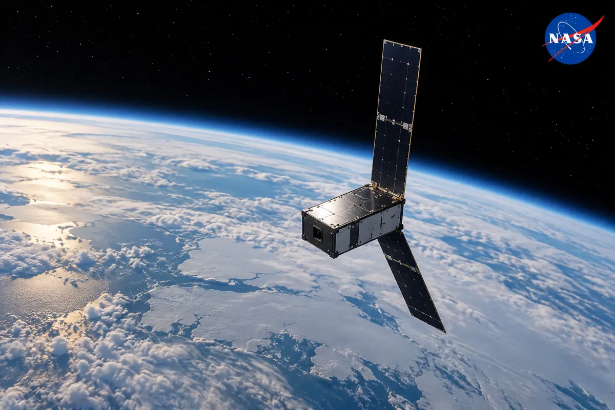
PREFIRE was designed to examine how Earth’s polar regions release heat into space. The Polar Radiant Energy in the Far-InfraRed Experiment pairs two small spacecraft carrying thermal infrared spectrometers. Its scientific target is a portion of the outgoing radiation spectrum that had received comparatively little systematic observation from orbit. Principal investigator Tristan L’Ecuyer, at the University of Wisconsin–Madison, connected the measurements with understanding the Arctic’s energy budget and improving climate models. In February 2024, the spacecraft were still awaiting launch. Their proposed contribution depended on measuring infrared emissions across changing atmospheric and surface conditions, rather than simply photographing ice cover. The subsequent launches, initial observations and data-processing work developed that prelaunch objective into a series of distinct measurement products.
Earth emits thermal radiation across wavelengths extending approximately from 4 to 100 micrometres. Around 60% of the heat escaping from the polar regions lies beyond 15 micrometres, in the far infrared. That polar proportion matters for an experiment aimed at the cold ends of the planet: instruments covering shorter wavelengths alone do not directly observe much of their outgoing thermal emission. PREFIRE’s spectral measurements were intended to distinguish contributions associated with water vapour, clouds and different surfaces, including ice and snow, within this longer-wavelength radiation.
The two spacecraft follow separate, asynchronous orbits. Their measurements can revisit a region at different times, sampling changes that a single fixed observation time would miss. The observing strategy therefore combines spectral information with temporal separation, rather than relying on one satellite’s repeated view alone. Students from the University of Wisconsin–Madison, the University of Michigan and the University of Colorado Boulder participated in the mission. Undergraduate and graduate students made up a significant portion of its science team, gaining experience with the satellite climate research programme.
Compact detectors, optics and calibration
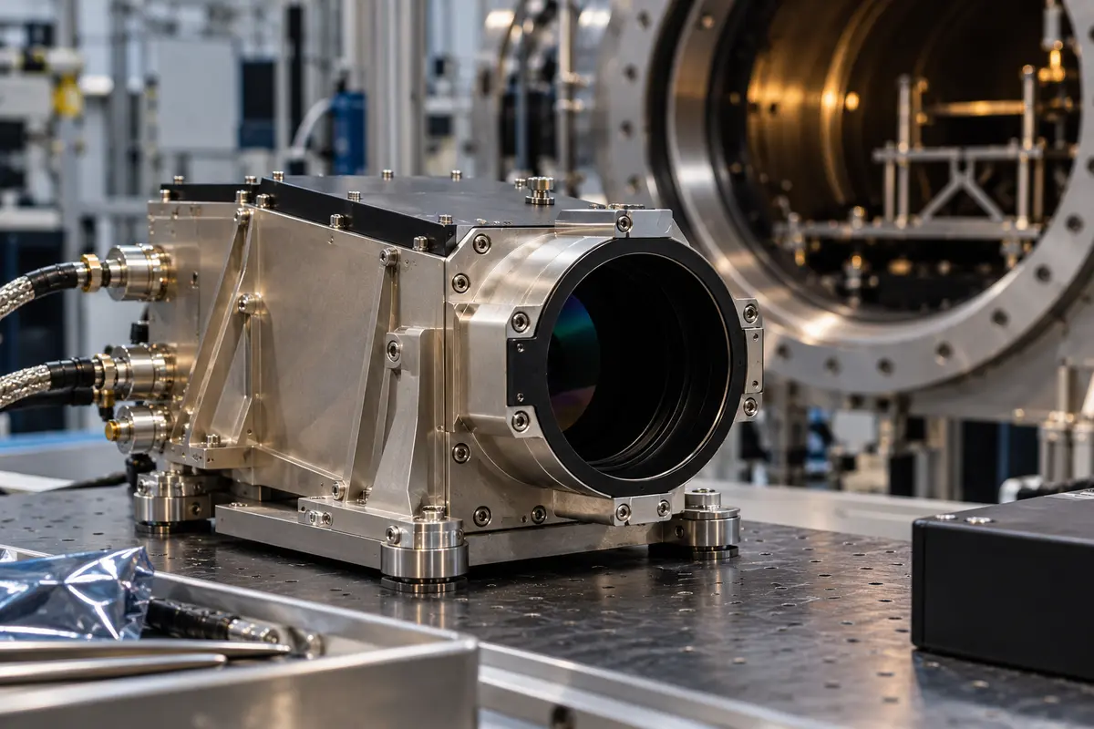
Each flight spectrometer has a mass of 2.7 kilograms and draws 4.3 watts; these are instrument figures, not the mass or power consumption of an entire satellite. Uncooled thermopile detectors avoid the volume and power demands of cryogenic cooling. Reflective optics and a shaped diffraction grating distribute the incoming radiation across the detector array. Order-sorting filters suppress unwanted diffraction orders that would otherwise mix radiation from different wavelengths. The compact assembly combines technologies with heritage in planetary thermal sensing and imaging spectroscopy.
The instrument characterization published in September 2025 distinguishes spectral sampling from resolution: 0.86-micrometre sampling accompanies 1.71-micrometre resolution below 35 micrometres. Thermal-vacuum tests assessed sensitivity, alignment and radiometric response before flight. A pointing mirror alternates Earth views with an internal calibration target and cold space. Those reference views support removal of the instrument’s own thermal contribution. Ground characterization also identified wavelength shifts, stray light and longer-wavelength response difficulties, with further assessment of thermal stability required in orbit.
The first PREFIRE spacecraft launched on May 25, 2024, aboard Rocket Lab’s Electron from Launch Complex 1 in Māhia, New Zealand. Liftoff occurred at 7:41 p.m. local standard time. NASA initially planned a 30-day checkout followed by ten months of scientific operations. Checkout involved confirming spacecraft and instrument functions before routine measurements could begin. The University of Wisconsin–Madison and NASA jointly developed the mission; the university’s responsibilities included processing the observations. NASA’s Jet Propulsion Laboratory supplied the spectrometers and managed the mission, while Blue Canyon Technologies built the CubeSats. Rocket Lab provided the launch. NASA’s Launch Services Program arranged that service through the Venture-class Acquisition of Dedicated and Rideshare framework, working with the Earth System Science Pathfinder Program. The small spacecraft and their scientific payloads consequently passed through separate development, launch and processing responsibilities. The first successful departure placed one observing platform in orbit while the other member of the planned pair remained to be launched.

Two launches and the first observations
The second spacecraft lifted off from Māhia on June 5, 2024, at 3:15 p.m. New Zealand standard time, corresponding to 11:15 p.m. Eastern daylight time on June 4. It communicated with ground controllers after launch. NASA corrected the launch photograph’s time caption the following day. The second flight completed the intended two-spacecraft observing arrangement, while its own checkout still lay ahead. Separate near-polar orbits allow the satellites to pass over the same region at different times of day. The mission’s intended comparisons include cloud formation, moisture changes and ice-sheet melt, phenomena that can alter far-infrared emissions between observations. Water vapour and the structure and composition of clouds affect how much radiation escapes into space. NASA programme executive Amanda Whitehurst identified improved climate and ice models as an intended use of the resulting observations. That prospective modeling benefit accompanied the launch announcement; it was not a measured improvement in forecast accuracy demonstrated by the launch itself.
The first-launched spacecraft began collecting science observations on July 1, 2024; the second started on July 25. NASA’s September presentation of early results included two passes over Greenland separated by nine hours in early July. Different infrared channels captured different aspects of the outgoing radiation. Brightness temperature expressed the measured intensity in temperature units, enabling comparison among the observations. The visual presentation extended coloured strips upward to separate channels for viewing; those extrusions were not measurements of vertically stacked atmospheric layers. The early release also distinguished observing from delivering usable products: a spacecraft could collect spectral data while its precise position still required additional processing. GPS difficulties delayed the public presentation. Both instruments nevertheless supplied observations from orbit, establishing an initial record for the mission’s measurement sequence. The early Greenland comparison was a particular pair of passes, rather than a global map of changes over an entire season or an evaluation of the accuracy of a climate prediction.
Both spacecraft’s GPS units were eventually disabled after problems with their performance. By NASA’s December 3, 2024, mission update, the team had established an alternative method for attaching geographic locations to the observations. The second spacecraft’s GPS problem was followed by difficulties with the first spacecraft’s unit, prompting the decision to switch both off. NASA stated that the GPS issue had not affected either satellite’s science operations. The second spacecraft started sending back science data in August, following the earlier start of collection. Initial public data products from both spacecraft became available in late October through NASA’s Atmospheric Science Data Center, with further products then scheduled for early 2025. Acquiring radiation measurements, geolocating observations and releasing processed products consequently have distinct dates in the mission’s development. Geographic information remained necessary for linking the spectral observations to the Arctic and Antarctic environments being investigated.

Position and quality belong to a product version
The initial R00 radiance-product guide documents limitations of that release. Reconstructed positions had estimated along-track errors reaching 50 kilometres, averaging about 30 kilometres; cross-track uncertainty had not been quantified. Those estimates belong to the initial processing version, rather than defining every subsequent PREFIRE product. Channel quality also varies. A 64-by-eight detector array retains entries for physically masked channels as fill values, so the dimensions of a delivered array do not mean every element contains a valid spectral observation. Each instrument has its own wavelength grid.
R00 uses three radiance-quality categories. Stray light, thermal drift and eclipse transitions contribute to channel-dependent restrictions. Calibration interruptions and downlink gaps interrupt observations. With no stationkeeping, orbital decay also changes footprints and coverage. Quality, geometry and spectral information must be interpreted for the specific product version:
- Good measurements carry flag 0.
- Uncategorized measurements carry flag 1 and require caution.
- Bad measurements carry flag 2 and become fill values.
Clouds introduce another set of distinctions. Liquid droplets and ice particles interact differently with infrared radiation, while cloud altitude influences the temperature at which a cloud emits. Clouds also reflect incoming sunlight and affect outgoing heat. Their warming or cooling influence depends on their properties and surroundings; a single blanket description does not represent all polar cloud conditions. Thin ice clouds and thicker liquid-water clouds can occupy the same broad region while leaving different spectral signatures. Their changing distributions complicate comparisons between observations taken hours apart.
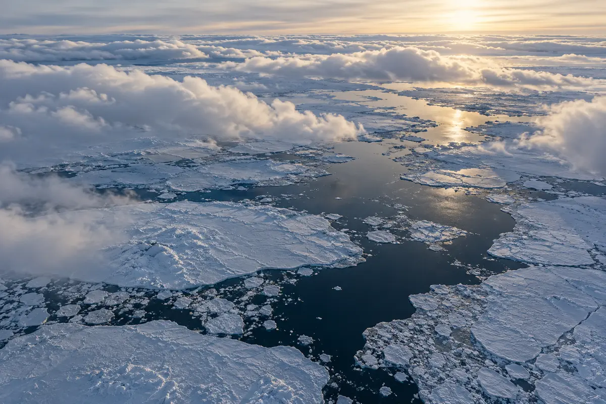
The mission’s cloud investigations connect those signatures with the atmospheric setting. Cloud particles can move and change over seconds to hours. Rain and snow redistribute water and energy, changing the clouds themselves as well as their radiative influence. PREFIRE’s paired observations were intended to help examine these evolving conditions. Its spectrometers were designed to detect approximate particle sizes and distinguish liquid droplets from ice particles. Those objectives connect the measured radiation with cloud composition, while cloud behaviour remains a variable component of the atmospheric conditions represented in climate models.
Separating cloud from clear sky
A neural-network cloud mask developed by Cameron Bertossa and colleagues in 2023 used simulated PREFIRE spectra to classify clear and cloudy scenes. Training drew on a high-resolution atmospheric simulation, and evaluation used a different model time. In the baseline test, overall classification accuracy was about 89%. Combining overlapping fields of view with surface temperature and total-column water vapour raised the tabled overall accuracy to about 92%; correct clear-scene detection reached 93%. These are simulation results, not flight-validation percentages. The cloud-mask experiment included assumed instrument noise but omitted calibration errors. Its cloud definition depended on a selected total-water-path threshold. High assigned confidence generally accompanied more accurate classifications, although the confidence behaviour differed between clear and cloudy classes. Far-infrared inputs improved clear-scene recognition and some higher-cloud detection, with more complicated effects for low clouds. The auxiliary meteorological inputs also lost their advantage when their assumed uncertainty became sufficiently large. Subsequent validation required real observations and independent cloud information.
An alternative principal-component cloud mask developed by Brian Kahn and colleagues used locally selected spectral training sets. Their November 2023 preprint applied 23 channels between 8.5 and 29 micrometres to simulated orbital segments. A similarity measure compared each spectrum with clear and cloudy patterns, while Otsu’s classification method selected a dividing threshold from the resulting distribution. The experiment used meteorological fields from one simulated day. Its performance depended on which training spectra were selected, particularly in complex polar scenes. For each segment, the method tested 25 combinations and retained the combination with the best agreement against known simulated cloud conditions. The authors identified the problem of applying that selection to an operational setting, where the true cloud state would not already be available. They proposed further work on training sets and postlaunch comparisons. The preprint consequently supplies a distinct cloud-screening approach and its development limits; its selected simulation results do not establish independent accuracy for routine satellite operations or replace validation with observed scenes.

From directional radiation to outgoing flux
PREFIRE measures radiance in its viewing direction. Spectral outgoing flux requires an additional calculation accounting for how radiation varies with angle. Xiuhong Chen and colleagues’ February 2026 validation used angular distribution models selected with cloud and meteorological information. Regression estimated unobserved or unreliable channels and radiation beyond the instrument’s coverage. The resulting broadband product therefore combines measured radiances with modeled information. Comparisons used R01 data and collocated satellite observations, rather than the initial R00 release alone.
For SAT-2, mean broadband differences against CERES were 2.8 watts per square metre in clear conditions and 2.7 in cloudy conditions; corresponding root-mean-square errors were 6.4 and 7.0. SAT-1 agreed less closely and met accuracy requirements sometimes marginally. The evaluation also compared clear-sky flux with calculations based on ground atmospheric profiles at CAPE-K in Tasmania, Australia. Such calculations are distinct from direct ground measurements of outgoing flux. The validation retained dependencies on radiance calibration, cloud classification and the auxiliary data used to select the angular model.
NASA extended PREFIRE in August 2025, with operations planned through at least September 2026 and analysis expanding from the poles to the whole planet. The instruments had already collected observations globally; the broader analysis changed the scientific scope applied to that record. Project scientist Brian Drouin highlighted differences in far-infrared emission associated with ice, including differences of up to 5% at longer wavelengths. L’Ecuyer identified future opportunities to investigate cloud particle size, moisture and applications in weather models. These were directions for scientific use, alongside the continuing task of characterizing observations and derived products. The extension decision did not itself demonstrate that forecasts had become more accurate, or establish that every planned month of later operation had been completed. PREFIRE’s public record includes launch events, early spectral observations, documented processing limitations and subsequent flux comparisons. Each addresses a different part of the mission, with its own date, measurement basis and uncertainty, as researchers develop the record of heat leaving the polar regions.
Leave a comment